Avalanche Terrain Analysis
Which slopes are dangerous? Where should backcountry routes go? Avalanche terrain analysis combines slope angle, aspect, elevation, and terrain shape to identify avalanche-prone areas. This model derives slope thresholds, implements terrain classification systems (ATES), and shows how to map runout zones using DEM analysis.
Prerequisites: slope analysis, terrain classification, hazard modelling, probability
1. The Question
Is this slope safe to ski, or will it avalanche?
Avalanche terrain analysis identifies hazardous areas based on:
Terrain factors (unchanging):
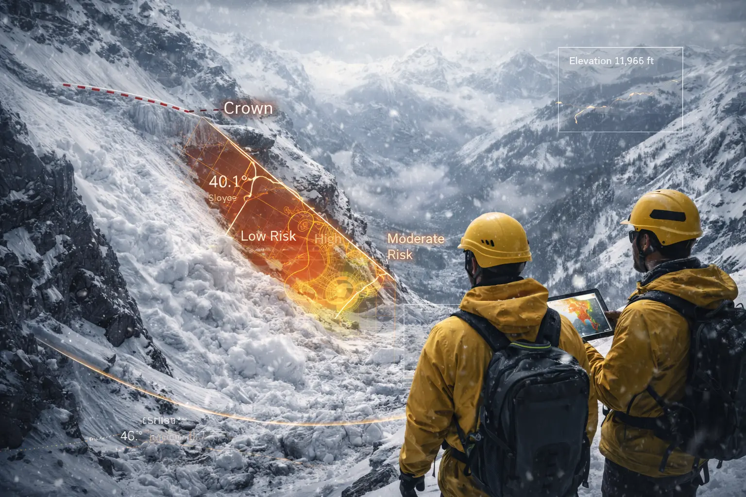
- Slope angle (30-45° = avalanche terrain)
- Aspect (wind loading, solar exposure)
- Elevation (snowpack depth/stability varies)
- Terrain shape (convex vs. concave)
- Anchors (trees, rocks that hold snow)
Snowpack factors (time-varying):
- Recent snowfall (loading)
- Wind (slab formation)
- Temperature (weak layer formation)
- Layer structure (buried weak layers)
Human factors:
- Route choice
- Group management
- Decision-making
The mathematical question: Given a DEM and snowpack conditions, how do we classify terrain by avalanche risk and predict where avalanches might run?
2. The Conceptual Model
Critical Slope Angles
Avalanche release zones:
\[\theta_{\text{start}} = 30-45°\]Why this range?
Below 30°: Snow doesn’t slide (friction too high)
30-35°: Common for wet loose avalanches
35-40°: Peak slab avalanche frequency
40-45°: Still avalanche, but less snow accumulates (sloughs off)
Above 50°: Too steep to hold deep snowpack
Most dangerous: 38° (statistically most fatal avalanches)
Avalanche Types
1. Loose Snow Avalanche (Sluff)
- Point release, fan-shaped
- Surface snow only
- Low danger unless terrain trap
2. Slab Avalanche
- Cohesive layer breaks as unit
- Wide fracture line
- Most deadly (accounts for 90% of fatalities)
- Requires weak layer beneath slab
3. Wet Avalanche
- Warm temperatures or rain
- Full-depth release (to ground)
- Heavy, destructive
ATES Classification
Avalanche Terrain Exposure Scale:
Simple:
- Primarily < 30° slopes
- Some avalanche terrain nearby
- Multiple route options
- Risk: Low
Challenging:
- 30-35° slopes common
- Exposure to avalanche paths
- Limited route options
- Risk: Moderate
Complex:
- Multiple 35-45° slopes
- Overhead hazard (terrain traps below steep slopes)
- Few safe zones
- Risk: High
3. Building the Mathematical Model
Slope Angle from DEM
Gradient magnitude (from Model 8):
\[|\nabla z| = \sqrt{\left(\frac{\partial z}{\partial x}\right)^2 + \left(\frac{\partial z}{\partial y}\right)^2}\]Slope angle:
\[\theta = \arctan(|\nabla z|)\]In degrees:
\[\theta = \arctan(|\nabla z|) \times \frac{180}{\pi}\]Finite difference (3×3 window):
\[\frac{\partial z}{\partial x} \approx \frac{(z_{i,j+1} - z_{i,j-1})}{2\Delta x}\] \[\frac{\partial z}{\partial y} \approx \frac{(z_{i+1,j} - z_{i-1,j})}{2\Delta y}\]Avalanche Hazard Classification
Based on slope angle:
\[\text{Hazard} = \begin{cases} \text{Non-avalanche} & \theta < 30° \\ \text{Low hazard} & 30° \leq \theta < 35° \\ \text{Moderate hazard} & 35° \leq \theta < 40° \\ \text{High hazard} & 40° \leq \theta < 45° \\ \text{Extreme steep} & \theta \geq 45° \end{cases}\]Alpha Angle (Runout)
Maximum runout distance:
Alpha angle from avalanche start to stop:
\[\alpha = \arctan\left(\frac{z_{\text{start}} - z_{\text{stop}}}{d_{\text{horizontal}}}\right)\]Empirical:
- Small avalanches: $\alpha \approx 28-30°$
- Medium avalanches: $\alpha \approx 25-27°$
- Large avalanches: $\alpha \approx 18-22°$
Runout zone: All terrain downslope from start zone where $\alpha > \alpha_{\text{threshold}}$
Example: Avalanche starts at 3000m elevation
- Alpha = 25°
- Stop when: $\arctan(\Delta z / d) = 25°$
- If horizontal distance 1000m: $\Delta z = 1000 \times \tan(25°) = 466$ m
- Stops at: 3000 - 466 = 2534m elevation
Terrain Traps
Features that increase consequence:
Gullies/Couloirs:
- Funneling effect (deep debris)
- Burial depth increases
- Hard to escape
Cliffs:
- Trauma risk
- Carried over cliff by avalanche
Trees (dense):
- Trauma from impact
- Difficult rescue
Flat areas below steep slopes:
- Appears safe but runout zone
- “Terrain trap”
Risk multiplication:
\[R_{\text{total}} = P_{\text{avalanche}} \times C_{\text{terrain trap}}\]Where $C > 1$ for terrain traps (amplifies consequence).
4. Worked Example by Hand
Problem: Classify avalanche terrain for ski route planning.
DEM elevations (meters, 30m cell size):
      j=0   j=1   j=2   j=3   j=4
i=0  2900  2880  2850  2810  2760
i=1  2920  2900  2870  2820  2770
i=2  2940  2920  2890  2840  2790
i=3  2960  2940  2910  2860  2810
Calculate slope angle at cell (1,1).
Solution
Step 1: Finite differences
At (1,1):
\[\frac{\partial z}{\partial x} \approx \frac{z[1,2] - z[1,0]}{2 \times 30} = \frac{2870 - 2920}{60} = \frac{-50}{60} = -0.833\] \[\frac{\partial z}{\partial y} \approx \frac{z[2,1] - z[0,1]}{2 \times 30} = \frac{2920 - 2880}{60} = \frac{40}{60} = 0.667\]Step 2: Gradient magnitude
\[|\nabla z| = \sqrt{(-0.833)^2 + (0.667)^2} = \sqrt{0.694 + 0.445} = \sqrt{1.139} = 1.067\]Step 3: Slope angle
\[\theta = \arctan(1.067) = 46.9° \times \frac{180}{\pi} = 46.9°\]Wait, that’s too high. Recalculate:
\[\theta = \arctan(1.067) \text{ radians} = 0.818 \text{ rad}\] \[\theta = 0.818 \times \frac{180}{\pi} = 46.9°\]Actually this is correct! The slope is 46.9° - extremely steep, minimal snow accumulation.
Step 4: Classification
$\theta = 46.9° > 45°$ → Extreme steep
Interpretation: This slope is:
- Too steep for most slab avalanches (snow sloughs off)
- Potential loose snow avalanches
- Not prime avalanche terrain (not enough snow accumulates)
- But dangerous for climbing/skiing (rockfall, sluffs)
Step 5: Calculate for (2,2) as well
\[\frac{\partial z}{\partial x} = \frac{2840 - 2940}{60} = -1.667\] \[\frac{\partial z}{\partial y} = \frac{2910 - 2870}{60} = 0.667\] \[|\nabla z| = \sqrt{2.778 + 0.445} = 1.796\] \[\theta = \arctan(1.796) = 60.9°\]Extremely steep cliff!
5. Computational Implementation
Below is an interactive avalanche terrain classifier.
Hazard distribution:
Non-avalanche: --%
Avalanche terrain: --%
Extreme steep: --%
Colors: ■ Safe (<30°) ■ Low (30-35°) ■ Moderate (35-40°) ■ High (40-45°) ■ Extreme (>45°)
Try this:
- Simple terrain: Mostly green (safe slopes)
- Moderate terrain: Mix of safe and hazard zones
- Complex alpine: More red/purple (steep avalanche terrain)
- Show hazard only: Gray out safe terrain, highlight danger zones
- Show aspect: Right panel shows slope direction (N=blue, S=red, E=yellow)
- Color code: Green=safe, Yellow/Orange/Red=avalanche terrain, Purple=extreme
- Notice: Most avalanche terrain clusters in gullies and ridge flanks!
Key insight: Terrain classification enables route planning—stay in green zones, minimize time in red zones, avoid terrain traps!
6. Interpretation
Route Planning
Decision matrix:
| Terrain | Hazard Level | Action |
|---|---|---|
| Simple (<30°) | Low | Safe travel |
| Challenging (30-35°) | Moderate | Assess snowpack, spacing |
| Complex (35-45°) | High | Expert only, stability tests |
| Extreme (>45°) | Variable | Sluff risk, limited accumulation |
Spacing:
- Simple: Group together
- Challenging: 50m spacing
- Complex: One at a time, safe zones
Aspect Considerations
North aspects (0-45°, 315-360°):
- Cold, persistent weak layers
- Longer avalanche season
- Higher danger in cold climates
South aspects (135-225°):
- Warm, quicker stabilization
- Wet avalanches in spring
- Lower danger in winter, higher in spring
East/West (45-135°, 225-315°):
- Moderate
- Wind effects important
Lee slopes (downwind):
- Wind-loaded slabs
- Very dangerous
Avalanche Bulletin Integration
Danger scale:
- Low
- Moderate
- Considerable
- High
- Extreme
Terrain selection by danger:
| Danger | Terrain |
|---|---|
| Low | All terrain OK (with normal caution) |
| Moderate | Avoid wind-loaded slopes >35° |
| Considerable | Simple terrain only |
| High | Avoid all avalanche terrain |
| Extreme | Stay home |
7. What Could Go Wrong?
DEM Resolution Issues
Coarse DEM (30m):
- Misses small gullies (terrain traps)
- Smooths cliffs
- Underestimates slope on convex features
Example: 30m DEM shows 35° slope, reality is 42° rollover.
Solution: Use highest resolution DEM (1-3m LiDAR ideal).
Wind Effects Not Captured
Terrain alone insufficient:
Wind loads lee slopes with thick slabs.
Example:
- West aspect, 38° slope
- Westerly winds → not wind-loaded (windward)
- Lower danger than expected from slope alone
vs:
- East aspect, 38° slope
- Westerly winds → heavily wind-loaded (leeward)
- Higher danger than expected
Solution: Wind models, weather data, field observation.
Human Factor
Most avalanche fatalities:
Victim or group member triggered avalanche (90%+).
Terrain selection just first step.
Also need:
- Snowpack assessment
- Decision-making skills
- Communication
- Rescue skills
Terrain analysis ≠ safety guarantee.
False Sense of Security
Green zones below steep slopes = terrain traps.
Example:
- Flat bench at 2500m (10° slope, “safe”)
- Above: 600m vertical of 38° terrain
- Runout zone extends to bench
- Extremely dangerous despite being “safe” slope angle
Solution: Alpha angle runout modelling.
8. Extension: Avalanche.ca Terrain Ratings
Canadian system:
Simple (Green):
- Exposure to low-angle or primarily forested terrain
- Some forest openings may involve steeper terrain
- Many options for route finding with overhead hazard minimal
- Avalanche terrain is avoidable
Challenging (Blue):
- Exposure to well-defined avalanche paths, starting zones, or terrain traps
- Options exist to reduce or eliminate exposure with careful route finding
- Requires knowledge of avalanche terrain and winter travel skills
Complex (Black):
- Exposure to multiple overlapping avalanche paths or large expanses of steep, open terrain
- Multiple avalanche starting zones and terrain traps below
- Minimal options to reduce exposure
- Requires extensive avalanche knowledge and winter travel skills
Implementation: Requires expert judgment + terrain analysis.
9. Math Refresher: Slope Stability
Mohr-Coulomb Failure
Shear stress vs. shear strength:
\[\tau = c + \sigma \tan\phi\]Where:
- $\tau$ = shear strength
- $c$ = cohesion
- $\sigma$ = normal stress
- $\phi$ = internal friction angle
On a slope:
Driving stress (downslope):
\[\tau_d = \rho g h \sin\theta\]Resisting stress:
\[\tau_r = c + \rho g h \cos\theta \tan\phi\]Failure when: $\tau_d > \tau_r$
Factor of safety:
\[FS = \frac{\tau_r}{\tau_d} = \frac{c + \rho g h \cos\theta \tan\phi}{\rho g h \sin\theta}\]Stable: $FS > 1$
Failure: $FS < 1$
Critical Slope Angle
For cohesionless material ($c = 0$):
\[FS = \frac{\tan\phi}{\tan\theta}\]Failure when: $\theta > \phi$
Dry snow: $\phi \approx 30-40°$ → slopes >40° unstable
Wet snow: $\phi \approx 20-30°$ → slopes >30° unstable
This explains why avalanches occur on 30-45° slopes!
Summary
- Avalanche terrain: 30-45° slopes most dangerous (slab avalanches)
- ATES classification: Simple/Challenging/Complex based on exposure and options
- Slope angle from DEM: Calculate gradient, convert to degrees via arctan
- Aspect matters: North (cold, persistent), South (warm, wet avalanches)
- Alpha angle: Predicts runout distance (typically 18-30° from start to stop)
- Terrain traps: Gullies, cliffs, trees amplify consequences
- Route selection: Minimize time in hazard zones, use safe travel protocols
- Limitations: DEM resolution, wind effects, human factors all critical
- Applications: Backcountry skiing, snowmobiling, forecasting, infrastructure
- Multi-factor: Terrain + snowpack + weather + human = avalanche risk
- Foundation for avalanche safety and terrain-based decision making